 3:37 AM
 Unknown

PAGASA-DOST weather bulletin issued at 5:00PM, 12 August 2012:
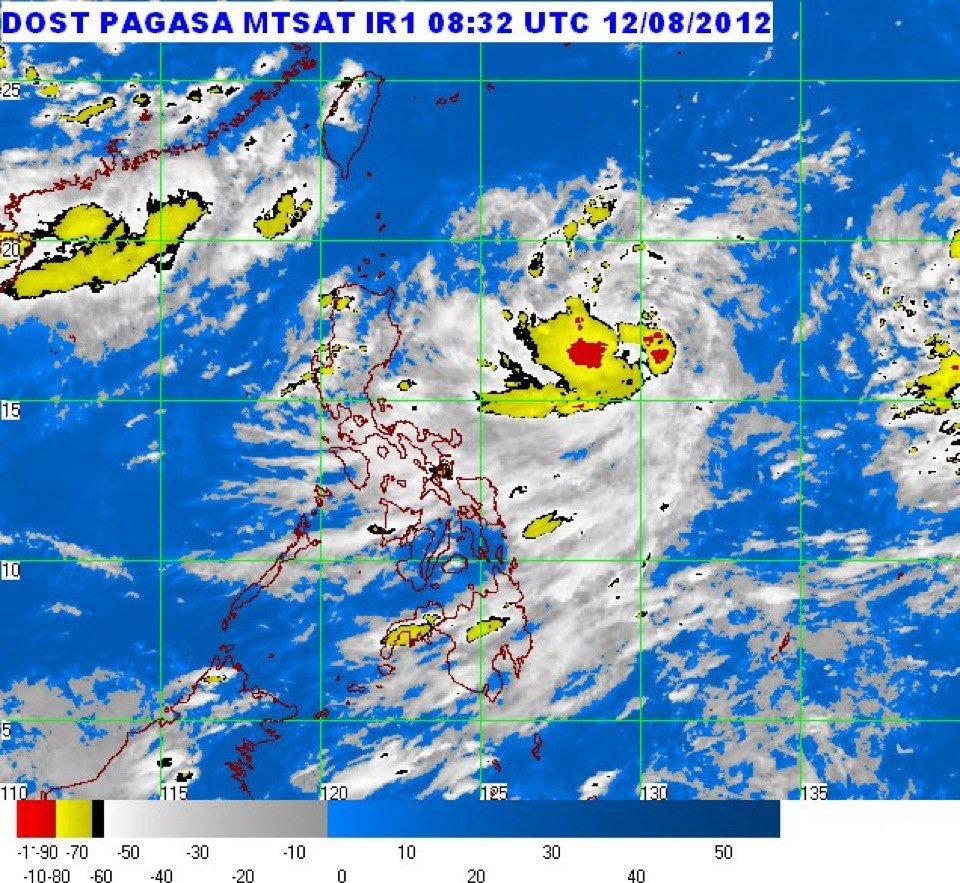
The active low pressure area East of Northern Luzon has developed into a Tropical Depression and was named "HELEN".
At 4:00PM today, the center of Tropical Depression "HELEN" was estimated based on satellite and surface data at 750 km East of Casiguran, Aurora (16.7°N 130.2°E) with maximum winds of 55 kph near the center. It is forec...
ast to move West Northwest at 11 kph.
Estimated rainfall amount is from 10 - 20 mm per hour (heavy - intense) within the 350 km diameter of the Tropical Depression.
Tropical Depression "HELEN" is expected to enhance the Southwest Monsoon that will bring rains over Southern Luzon, Visayas and Mindanao especially the Western section.
The Entire Archipelago will experience mostly cloudy skies with scattered rainshowers and thunderstorms becoming cloudy with widespread rains over Bicol region which may trigger flashfloods and landslides.Moderate to strong winds blowing from the Southwest will prevail over Luzon and Visayas and the coastal waters will be moderate to rough. Elsewhere, winds will be light to moderate coming from the Southwest to West with slight to moderate seas.
 Posted in: News,Tropical Depression Helen,Weather


0 comments:
Post a Comment